Pinnacles National Park Map
Pinnacles National Park Map
Couldn't load pickup availability
by Tom Harrison Maps, 2025.
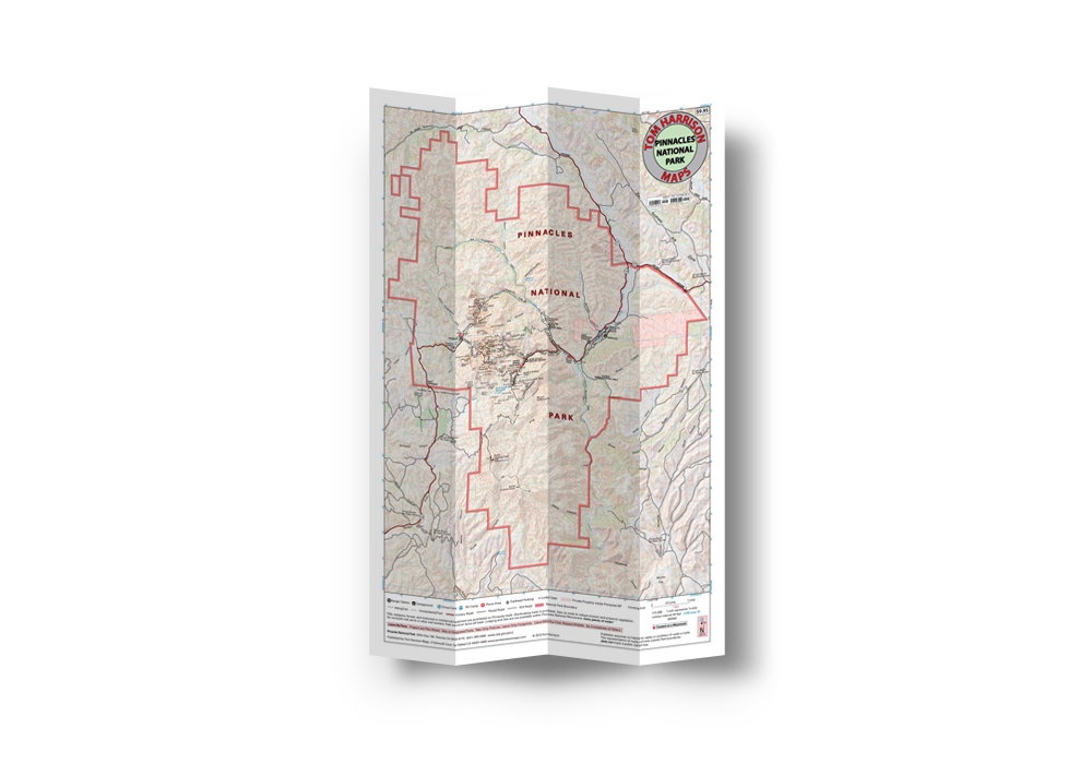
One of America's newest national parks, Pinnacles National Park was established in 2013 to protect rock formations in the Salinas Valley. Some 23 million years ago multiple volcanoes erupted, flowed, and slid to form what would become Pinnacles National Park. What remains is a unique landscape. Travelers journey through chaparral, oak woodlands, and canyon bottoms. Hikers enter rare talus caves and emerge to towering rock spires teeming with life: prairie and peregrine falcons, golden eagles, and the inspiring California condor. Pinnacles is where you are most likely to see an endangered California condor in the wild. Pinnacles National Park is the ancestral homeland of Chalon and Mutsun groups of the Ohlone people.
The park--less than a four hour drive from most areas in our region--also features more than 30 miles of trails that showcase the beauty of the park up close and personal. Hikes range from flat stretches of grasslands to uphill climbs through talus caves onward to the rocky spires that Pinnacles is famous for.
This durable, waterproof topo map will also help you find popular rock climbing areas like Tourist Trap, Discovery Wall, Passion Play, Game Show, Chockstone Dome, Flumes Formation, and High Peaks. Pinnacles Campground offers tent and group camping, along with RV sites, canvas-sided tent cabins, a campground store, and a swimming pool open during spring and summer.
Tom Harrison Maps publishes some of the best full-color, shaded-relief topographic maps for hiking, backpacking, and mountain biking in parks, forests, and wilderness areas in California.
Share